Ostrica, Louisiana

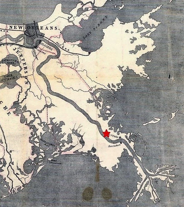
1853 map of with the location of Quarantine Station. Courtesy of the Library of Congress.

The site of the Ostrica, Louisiana has a storied history. Situated 75 miles downstream of New Orleans just across the Mississippi River from the current settlement of Buras, Louisiana, the area has served as a quarantine station, and oyster cannery, and the site of a series of navigation locks that served for more than a century.

In 1855 a quarantine station was established. Abandoned by the 1860s, the station had several large buildings and a staff. This was set up to make sure ships were disease free before making their way to the city.

In 1857 a French naval vessel, the Tonnerre, stopped to seek shelter. During its journey at sea, and stay at the quarantine station, more than 30 sailors died. The sailors were buried in the cemetery nearby, the location of which seems to be lost to history. In 1917, the deceased crew members of the Tonnerre were meticulously disinterred and relocated, along with a stone obelisk, to the St. Louis Cathedral in New Orleans’ French Quarter. You can read more about that history here.

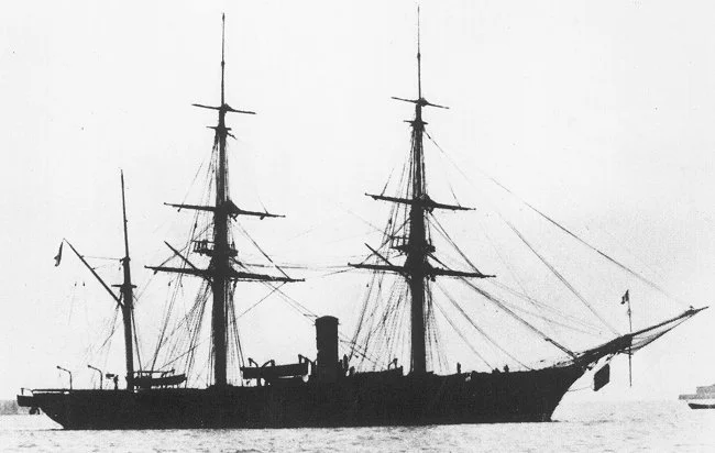
Tonnerre, courtesy Wikimedia Commons.

Sometime in the 19th century, an encampment of Yugoslavian immigrants settled in the area of Quarantine Bay adjacent to Ostrica in single, one room camps. These were built in support of oyster cultivation that was being pioneered at the time.

In the 1880s, a set of locks was constructed at Ostrica. This water access route provided reliable and efficient means to navigate from back bays directly into the Mississippi River and speeded the transport of the perishable cargo.

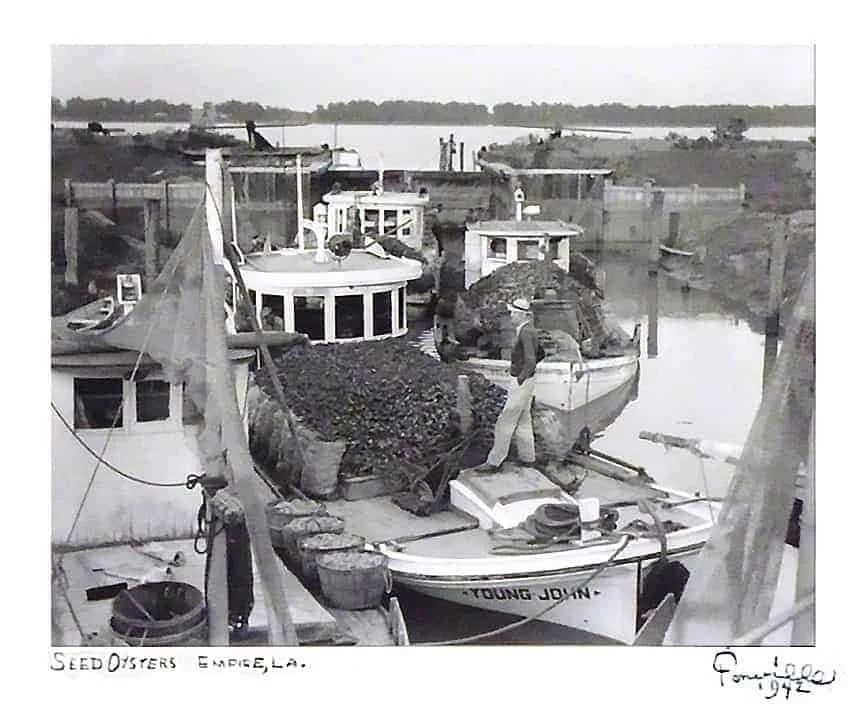
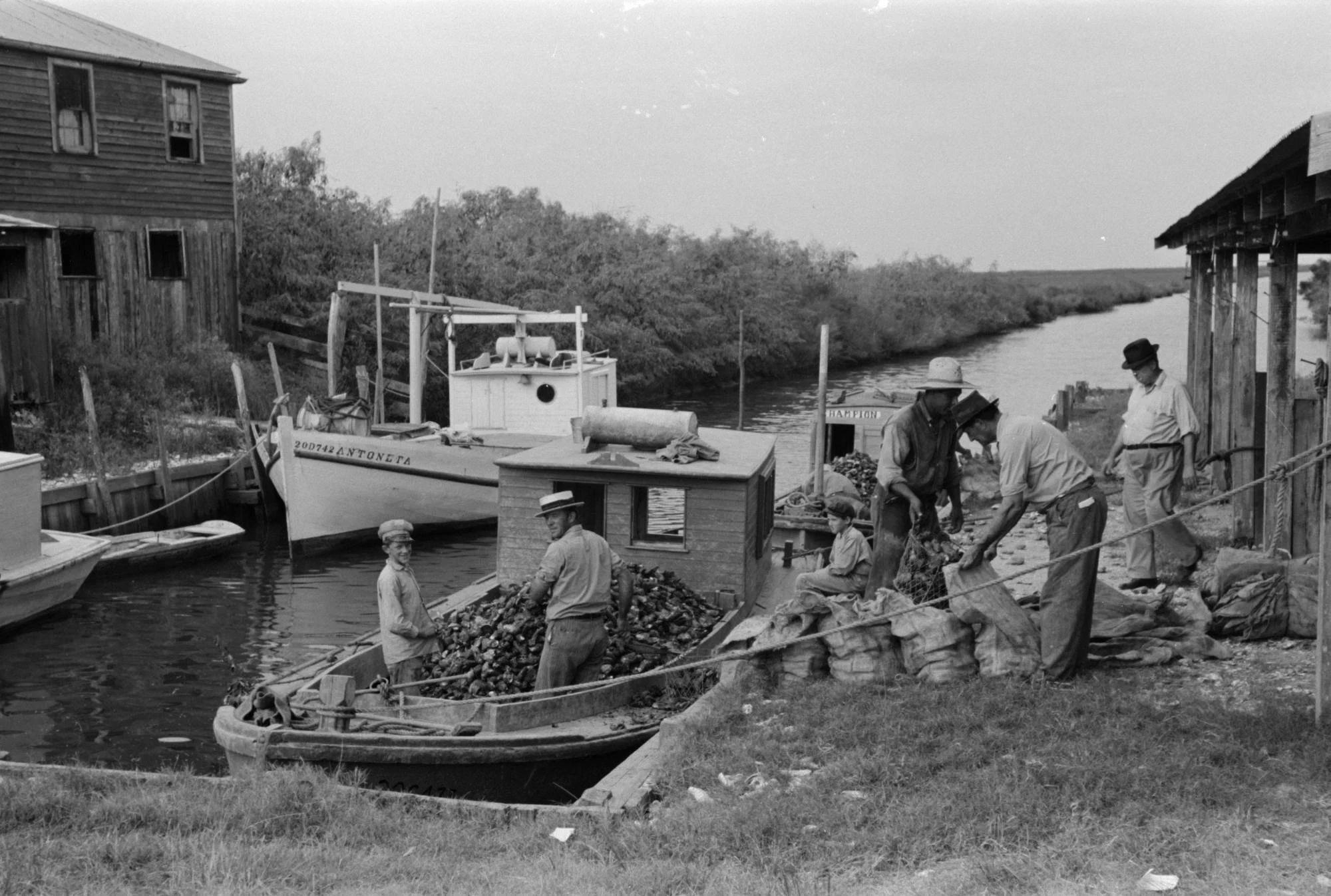
Photo of adjacent Empire Locks by Fonville Winans. This lock with wooden gates and earthen walls was similar to the original lock structures at Ostrica.

Milos M. Vujnovich sums up the need for he Ostrica Locks in his 1974 book Yugoslavs In Louisiana:

Before the opening of The Empire and the Ostrica Locks during the early 1900s, this was lone by a long, indirect, and tedious route. They would load the boats with the seed oysters from the public reefs on the east side of the river. During the months when the river level was high, they would enter the Mississippi at the Baptiste Collette Bayou (about five miles below Olga), cross the river and at the Jump, near Venice, enter the Grand Pass and go southward to the Gulf of Mexico then turn in a northwesterly direction, enter the Bastian Bay at Grand Bayou Pass, cross the Bastian Bay and proceed to Bayou Cook, Bayou Le Chutte, Ferrand Bay, Ferrand Bayou, or Adams Bay, transfer the oysters to a smaller skiff, and bed them. The smaller boats, which could not dare the open seas, usually followed this route.

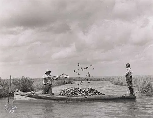
Photo by Fonville Winans. Tonging and bedding oysters was common at Ostrica. This photo was taken south of Morgan City.

Eventually an oyster cannery was built to service nearby reefs. Over time a surrounding village coalesced at Ostrica, which is the Croatian word for oyster.

Carolyn Ramsey writes in her 1957 book, Cajuns on the Bayou about the spartan quarters built by folks gaining a foothold in the United States while visiting via packet boat.

This narrow man-made canal… “Mostly dug by Cap'n Pete [Zibilich] hisself”… was a straight blue-grey shaft through the tall weaving draperies of marsh grass that surrounded us on either side. Down it the little lugger traveled smoothly, taking us out of the world of the oyster settlement and into the great flat prairies of grass, water and skies that stretched far and wide around and above us. There was an immensity to this landscape that took away the need for speech.

A modest oyster cannery was located nearby the Ostrica Lock which inspired its namesake.

We rode silently together until we sighted a tiny hut far out upon the sea of marsh grass. As we came nearer I saw that it stood on spindly wooden legs like stilts, six feet above ground.

Surrounding it and beneath it was a blanket of oyster shells, gleaming white and clean in the late sun's rays. No sprig of grass, no flowers, no unfunctional thing. Narrow, wobbly steps led up to the single room. Draped over them at the top was a throw net and leaning against the house were push poles, a boat anchor, a large coil of rope, several pairs of oyster tongs. Tied to one of the house piers were two skiffs, oars stacked neatly inside.

Prior to the construction of the locks at Ostrica, oyster growers relied on packet boats that would work a rotation between New Orleans and smaller coastal settlements.

In 1953 a modern iteration of the Ostrica Lock was constructed as oil and gas exploration expanded in the area. Oyster cultivation was modernized around the same time taking advantage of advancements in hydraulics and management techniques for wild reef productivity. This new lock had concrete walls and steel gates.

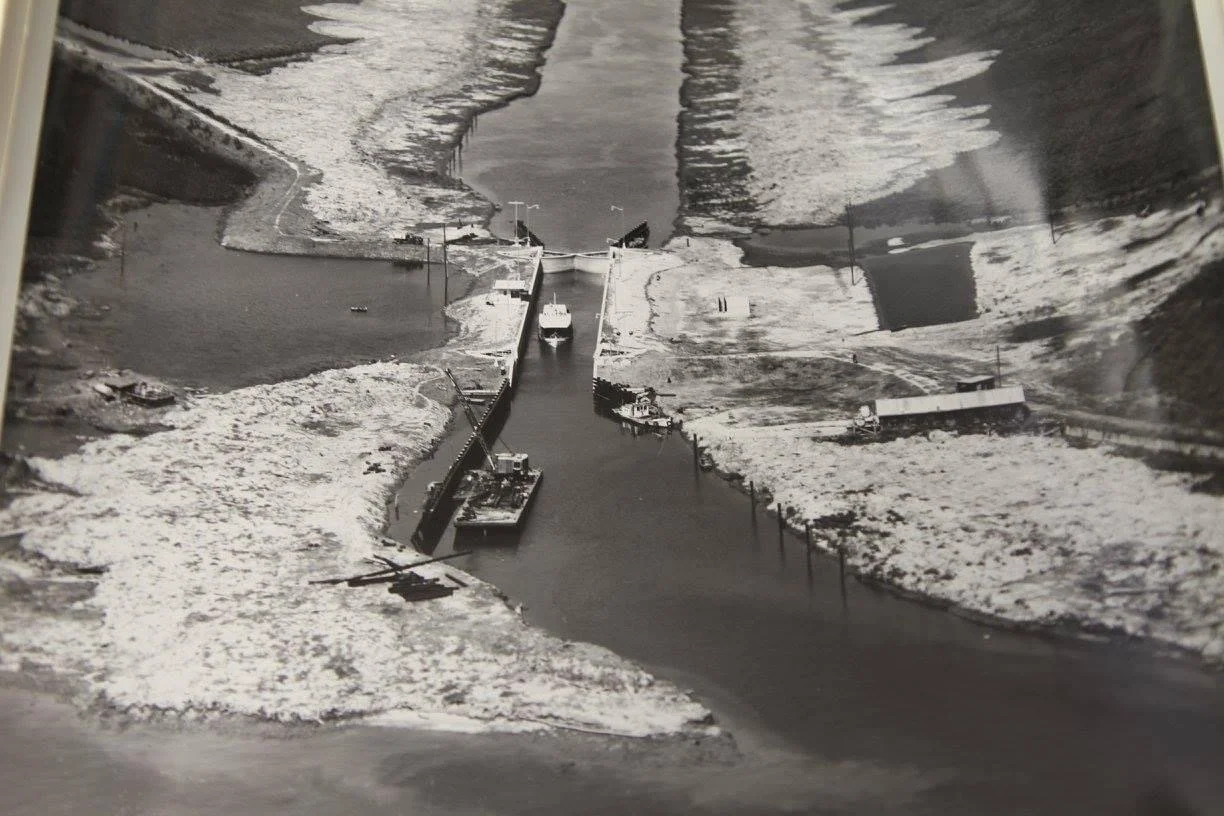
The modern iteration of the Ostrica Lock during the 1953 construction.

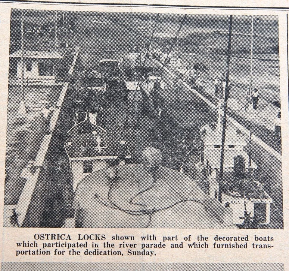
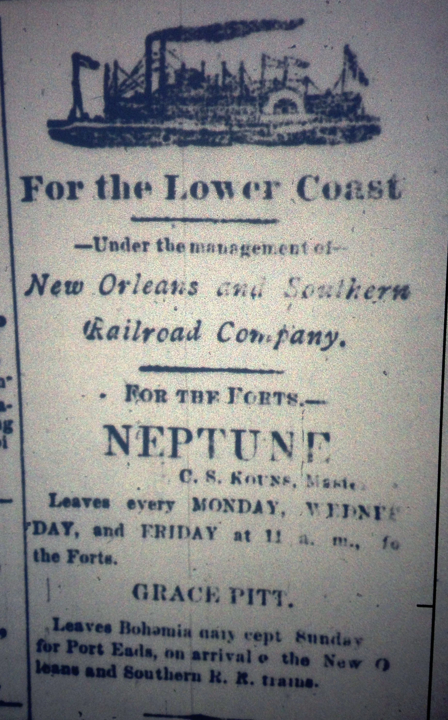
Newspaper clipping from the opening of the 1953 iteration of the Ostrica Lock.

Courtesy of the American Canal Society

Ostrica soon became an important hub for oil and gas development in Louisiana. The abundant oil reserves within Quarantine Bay and deepwater access of the Mississippi River created the right ingredients for a burgeoning industry.

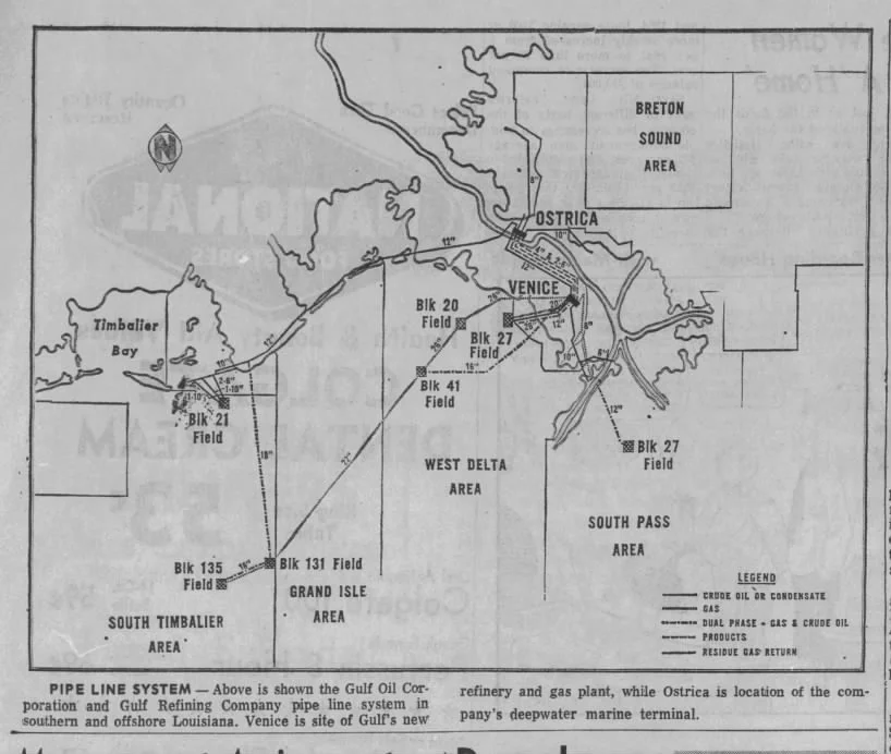
Gulf Oil Company drilled many wells and created an oil shipping depot on the banks of the Mississippi. The company installed compressors and gathering stations to lift and process crude oil before shipping it via barge to refineries upstream. As oil and gas drilling and production ventured further offshore, a pipeline network became more advanced. Eventually a 104 mile long pipeline was built to directly connect the nearby terminal to a refinery in Pascagoula, Ms.

These facilities became modernized over the years. Today Ostrica is home to the Chevron Empire Terminal, which is capable of landing tankers of at least 750’.

Eagle Hanover loading at the Chevron Empire Terminal. Photo by author.

Hurricane Katrina caused great devastation to the area in 2005. The lock was in a state of disrepair and out of service for years after the storm. To facilitate navigation, the lock was left wide open for several years for during repairs to the lock keeper’s quarters and support buildings. After repairs, the lock was brought back into service for about a decade.

In 2010 there was much uncertainty during the 87 day long Deepwater Horizon spill. Locals and resource managers were grasping for ways to blunt the ecological impacts from the massive amounts of crude oil floating in the Gulf of Mexico. One of the tactics to prevent oil slicks from reaching interior marshes was utilizing existing diversions and the Ostrica Locks to create a hydrological head. To do this, the lock operations regiment was reversed. Instead of a constant state of closure, with each gate opening to step down boats from the level of the Mississippi River to the Gulf of Mexico, the lock gates were both opened to allow for large amounts of water to inundate adjacent wetlands and prevent any oil slicks from entering sensitive marshes. This move upset some fishing operators.

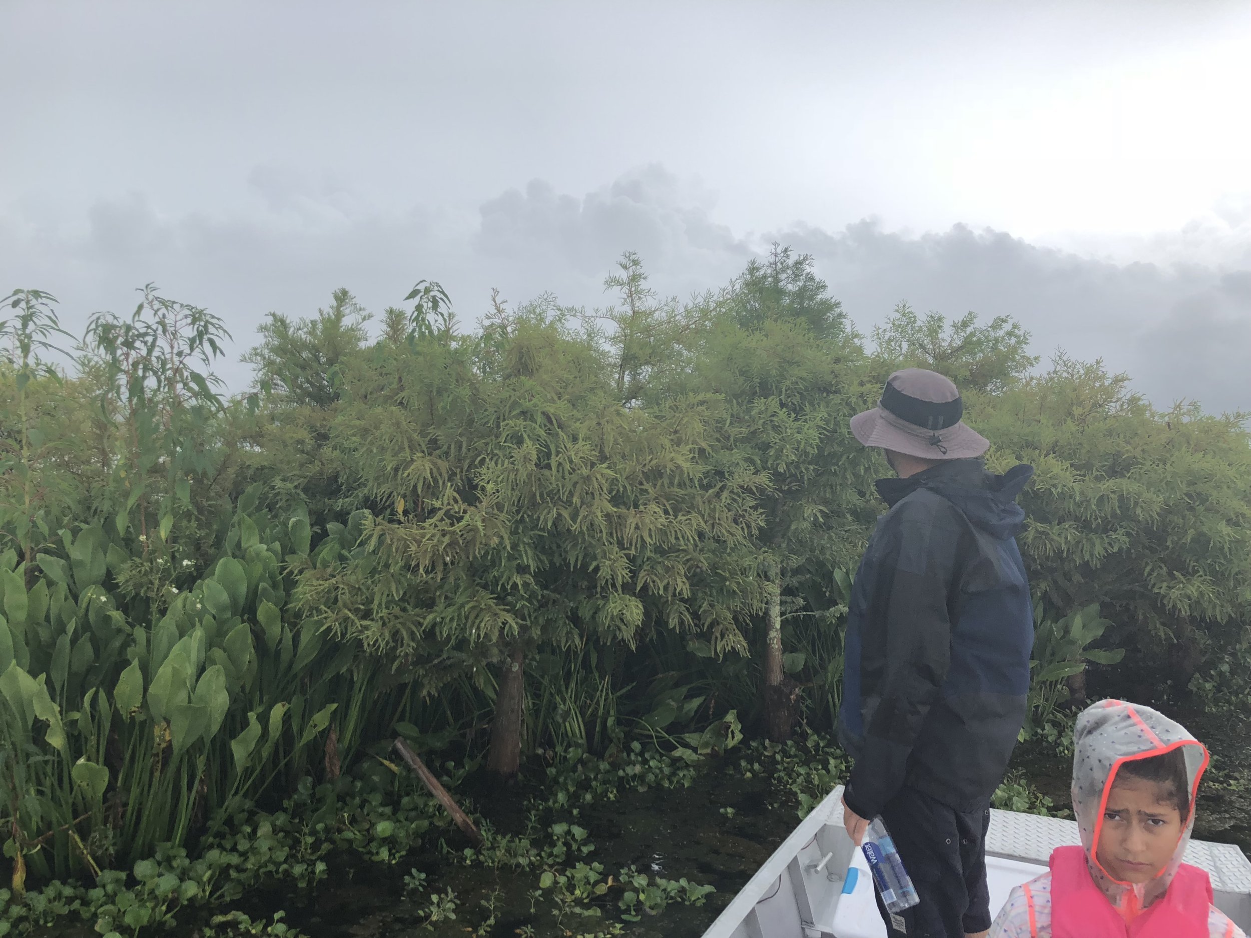
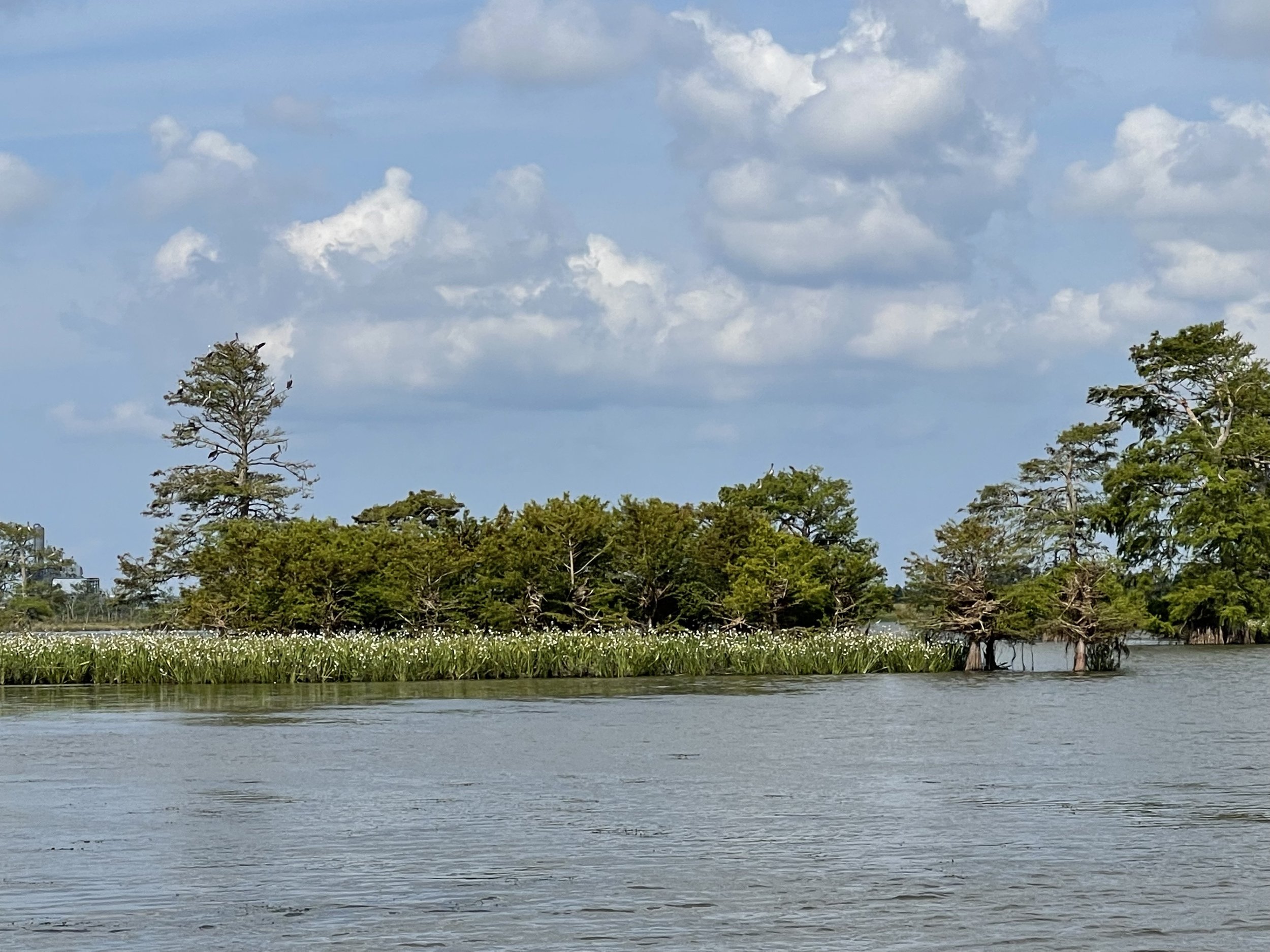
Captain Phillip Simmons, a cattle rancher, during the Deepwater Horizon Oil Spill in 2010. The background of this image looks drastically different today with many willows nearing 30’.

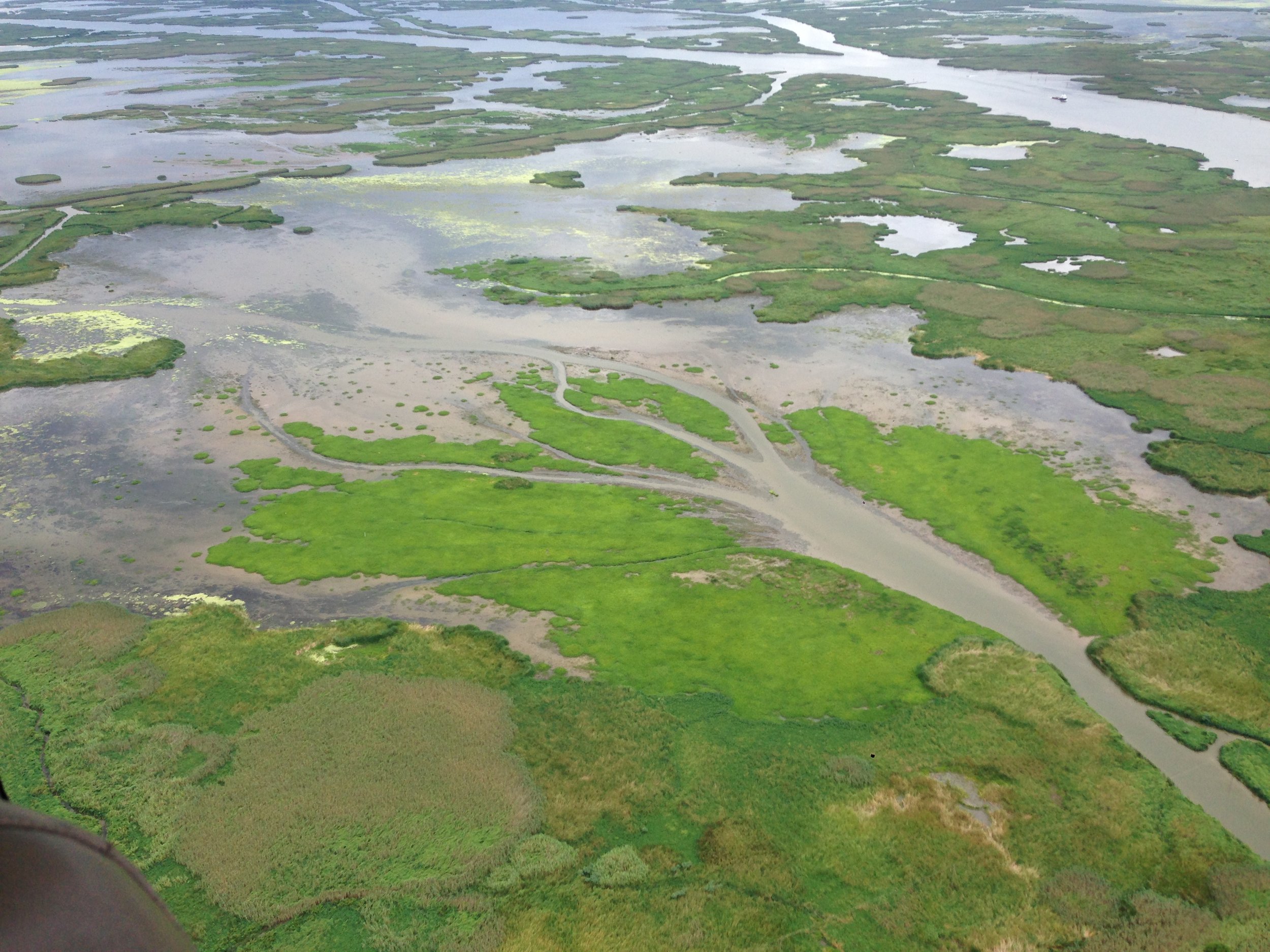
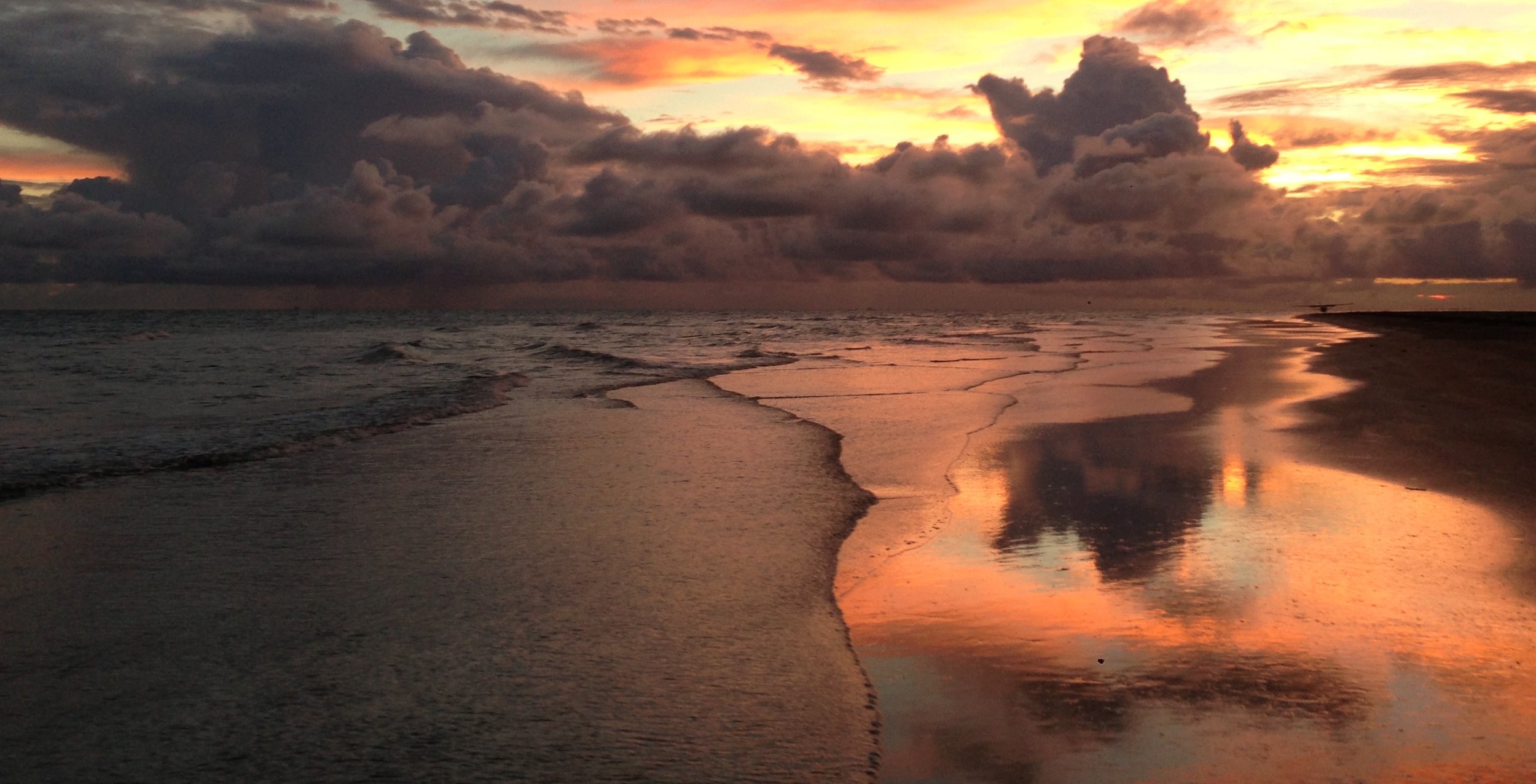
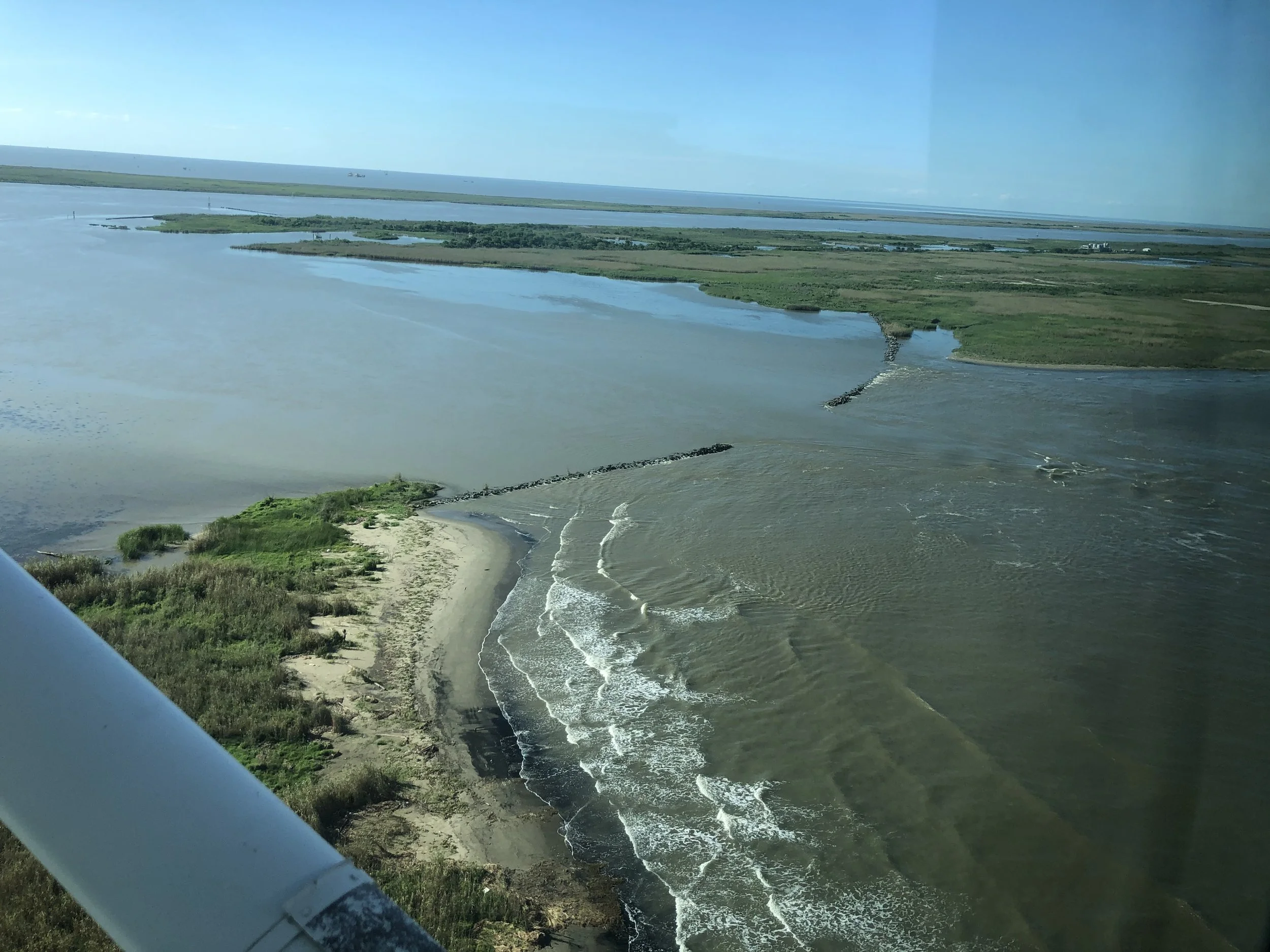
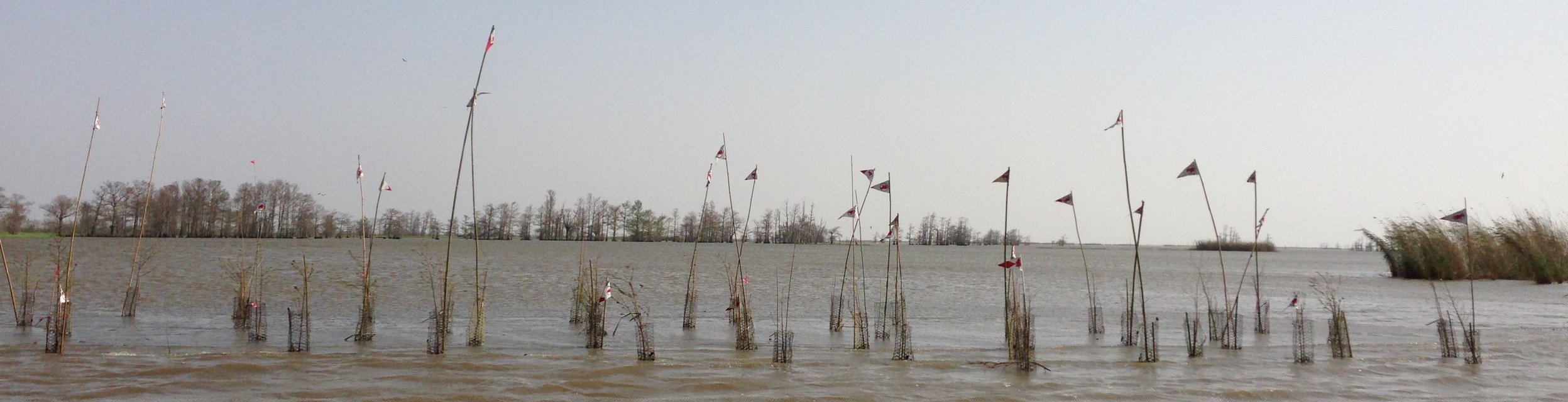
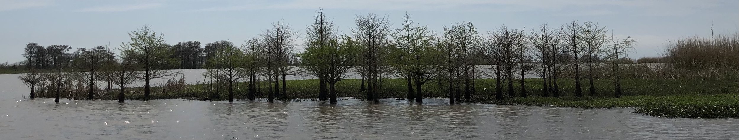
In 2004 a small cut began to develop just downstream of the locks. That cut, which locals simply call Ostrica Cut, is today a navigable waterway. In 2019, the development of Neptune Pass created a new large channel making the locks obsolete.

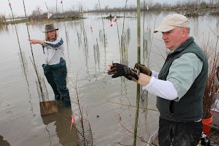
How we think about infrastructure, its use and reuse, is going to be key in how we deal with blunting the impacts of a changing climate. In the future, it may be possible to utilize the lock chamber as a sediment diversion, or for other water control uses. The health of a large wetland area upstream of the lock could be managed with this structure. Ostrica has had a long and varied history, its future can be just as interesting and productive.

-Richie

Species Migration

Mangrove root crab observed June 27, 2022

Experts say climate change is expanding the tropics resulting in the migration of animals and plants north and southward. That’s easy to see on the water here in the delta. On a recent trip we observed a mangrove root crab. These crabs are native South America and the Caribbean. On the iNaturalist app, the next furthest north mangrove root crab sightings in the Gulf of Mexico have been at latitudes near Corpus Christi, Texas, and Tampa Bay.

Mangrove root crab range

Maybe the crab floated into the area on some flotsam or jetsam? Could temperatures have become mild enough for this species to establish a population in the already prolific mangrove stands that dot the Mississippi River Delta? Only time and further investigation will tell.

Black bellied whistling ducks

The mangrove root crab is not the first species to have an expanded range. Species like black bellied whistling duck have established prolific breeding populations in Louisiana over the last ten years or so. Even the latest charts with the duck’s range have not been updated to reflect these changes just yet. Human caused changes to the ducks habitat could be just as responsible as the climate, nevertheless this species seems here to stay.

Perhaps we should ask ourselves what species should we expect to join us here in the future? What may the climate look like and different points in the future? What species of plants that are not here currently, will be thriving here later? How do we navigate the moral and ethical dilemma of preparing this place for future conditions using plants and animals that will be more suited for the environmental conditions of tomorrow? How will business and industry step up to both mitigate climate change and to help communities and ecosystems adapt? How will climate extremes make this easier or harder?

For now, I’ll continue to monitor what drifts in from the high seas.

A Quick and Dirty Guide to Exploring the Mississippi River Delta

Delta Discovery Tours

If you're looking to take an educational tour of Louisiana's wetlands, you have come to the right place. Now, time to pick your ideal coastal experience.

It is no secret that any trip with Delta Discovery Tours is a unique experience, unlike any other. On any ecotour you choose to take with Captain Richie Blink and the growing Delta Discovery Tours team, you are sure to have a memorable time and leave with a whole new perspective of the Mississippi River Delta. In this rapidly changing landscape, what you saw ten years ago may not be the same as what you see today or what you’ll see ten years from now. This is not your run-of-the-mill swamp tour. Each experience is tailored to your interests, guided by an expert in this area. Just a short drive from New Orleans, these eco-adventures offer an entirely different way to experience the coast. If you're looking to take an educational tour of Louisiana's wetlands, you have come to the right place. Now, time to pick your ideal coastal experience.

Delta Discovery Tours offers a range of excursions. From the most popular Delta Circumnavigation trip to Overnight Beach Camping, there is something for everyone. Here's a quick overview of each trip to help you narrow it down. Not to worry, though; any tour you take is sure to be a worthwhile adventure!

DOLPHIN EXCURSION:

A quick 3-hour trip into the delta, this dolphin excursion is perfect for families with younger children. At $100 per adult and $50 per kid (10 and under), it is the most cost-effective trip offered. This dolphin tour is the only of its kind in the area and visitors are sure to see an abundance of playful pods. Take a break from the hustle and bustle of the French Quarter and escape to a little slice of heaven.

DELTA CIRCLE

This 6-hour trip is the most comprehensive on-the-water ecotour experience in Louisiana. This tour takes visitors to each coastal subtype in the Mississippi River Delta- from the river itself to barrier islands, and the marshes and swamps in between. Visitors explore geologic and human history on this sixty-mile route with a highly experienced tour guide. This totally immersive encounter is ideal for individuals or groups looking to see the stunning wildlife and vast wetlands of this robust, working coast. It is simply a one-of-a-kind adventure, making it our most popular excursion.

BIRDING SAFARI

This 6-hour, 60-mile trip is for the birding enthusiast, avid birdwatcher, and photographer. An experienced guide will transport guests throughout the Mississippi River Delta from the river to the barrier islands, stopping along the way to appreciate the vibrant wetlands that give way to these feathered friends. The delta is home to thousands of wintering waterfowl, wading birds, secretive marsh birds, raptors, shorebirds, and more; making this birding excursion a special experience for any level birder. On this birding tour, guests are likely to see endangered species and even migratory visitors depending on the time of year.

BIRDSFOOT TOUR

This trip is a 60-mile loop for anyone interested in visiting the mouth of the Mississippi. Experience as the water shifts from fresh to salty when the river meets the ocean and check this off your bucket list. This mighty Mississippi River, which begins as a trickle in Minnesota and works its way down to the Gulf draining a whopping 33 states on its way, is a vital piece of Louisiana culture. This 6-hour tour is layered in natural and human history and is perfect for couples or groups.

BEACH CAMPING

This camping excursion is for the avid adventurer, interested in spending time immersed in the wilderness of the Mississippi River Delta. This trek down to the southernmost point in Louisiana gives visitors a unique opportunity to explore uninhabited beaches, see the Milky Way, and unplug on the edge of the continent. This Mississippi River camping trip is weather and water-level dependent, which means visitors need to remain flexible. Nothing about this experience is cookie-cutter. Changes to the route, camping areas, and itinerary happen often to adjust to changing tides, winds, and weather. These trips are run in cooler months from October 1st until March 31st and are perfect for couples or groups looking for an experience of a lifetime.

PADDLER PICK-UP

If you are journeying from the start of the Mississippi to the mouth by paddleboard, then this arrangement is for you. In this feat of human achievement, you dodged weather and barges. You have made it through long stints in the wilderness with just your craft and wits. There is one last detail, how to get back upstream the roughly twenty-five water miles past the nearest road? After paddling for sixty to eighty days, a ride back upstream is a welcomed luxury. Delta Discovery Tours is happy to accommodate. At the end of your paddle adventure, your friendly captain will be there to greet you with a warm smile and a way home.

CUSTOM TRIPS

Submit a trip inquiry to book your next school field trip, artist outing, research exploration, photography adventure, film trip, or fun excursion outside of New Orleans. We are happy to accommodate the perfect trip for artists, students, scientists, photographers, researchers, filmmakers, travelers, and explorers. You must provide your own travel accommodations to Venice, LA.

Still unsure which trip is the perfect fit? Take this quick and easy quiz to help narrow it down!

Avulsion Pass

a·vul·sion

/əˈvəlSHən/

noun

  1. MEDICINE

    the action of pulling or tearing away.

    • LAW

      the sudden separation of land from one property and its attachment to another, especially by flooding or a change in the course of a river. The act of pulling or tearing away.

Small boat upbound in Avulsion Pass with a warship in the main channel headed to New Orleans. Photo by James Collier

Avulsion Pass is the newest distributary of the Mississippi River. Beginning as a small unnamed cut near Buras, Louisiana just downstream of the former village of Ostrica, Louisiana on the east bank, this new distributary of the Mississippi River is deep, powerful, and here to stay.

Bound by the laws of physics to get to the sea without delay, the Mississippi River is beginning to shave off 40 miles of river and passes to create a new outlet to the Gulf of Mexico.

Located at 24 miles above Head of Passes, and around 71 miles downstream of the French Quarter, as of this writing in late April 2022, Avulsion Pass is 810’ across and 45’ deep in most places with a sizable canyon carved to -95’ where the cut meets the river. In some places nearer to Quarantine Bay, depths greater than 80’ exist. A former levee was losing around two feet of ground daily while the river was at its peak. While not unprecedented, nothing quite like this has happened this generation in the delta. This new waterway is the avulsion long predicted for the Mississippi River.

Unlike Mardi Gras Pass, with an extensive and complicated pre existing distributary network, Avulsion Pass is a direct shortcut to the Gulf of Mexico. No obstructions currently exist at this location between the Mississippi and the Gulf of Mexico.

Mile Marker 24, twice replaced by the Coast Guard due to erosion and high currents, now stands just downstream of Avulsion Pass. Photo by James Collier

From observing the crevasses’ development over the years it seems that the cut has had three major stages of development so far.

  • Starting as a small crevasse left unchecked, rock and articulated concrete matting revetments failed under constant flow in a similar process to Niagara Falls’ erosional patterns, but underwater and out of sight. Softer clays and sands under the revetment were displaced over time. This happened on the back side of the revetment, out of the main river channel until sufficient depth was reached for what happened next.

  • An Island suddenly disappeared over a few weeks. With this bottleneck removed, the capacity to move more water increased significantly. Around this time, in just thirty months or so, the cut grew tremendously in size from the surface perspective.

  • Today’s condition: Continued capacity building. Avulsion Pass is not finished. With depths as much as 30’ near the banks of Avulsion Pass, the Mighty Mississippi is allowing more water to pass through daily.

A fine balancing act exists to keep commerce moving. Using a jetty concept developed by James Buchanan Eads, a high velocity is needed to keep channels self scouring for navigation requirements. Ships have grown to dizzying proportions and the draft of the channel has been deepened over the years. Still, the concept of self scouring and dredging the leftovers has remained static since the turn of the last century. Humanity is operating the system in perhaps an 1880s way of thinking. Maybe this new development will allow for some 21st century solutions to managing the lower river?

As published in National Geographic in 1897, shortly after the river levees and jetties were built, these enormous economic benefits would come at a cost:

“…No doubt the great benefit to the present and two or three following generations accruing from a complete system of absolutely protective levees… …far outweighs the disadvantages to future generations from the subsidence of the Gulf delta lands below the level of the sea and their gradual abandonment due to this cause. While it would be generally conceded that the present generation should not be selfish, yet it is safe to say that the development of the delta country during the twentieth century by a fully protective levee system, at whatever cost… …will be so remarkable that the people of the whole United States can well afford, when the time comes, to build a protective levee against the Gulf waters.”

Corthell, E. L. “Delta of the Mississippi River.” National Geographic. Dec. 1897: 351-354.

It’s now time to act. A tremendous opportunity is present for nature to be leveraged. In the past, humanity has not been the best at taking care of the delta. The delta has had declining landmass over the last century. Somewhere on the order of 2000 square miles of land have been lost to the gulf due to short sighted management techniques dialed narrowly on certainty of commerce. Avulsion Pass can create a new massive subdelta.

I worry that the Corps gets to work with its business-as-usual way of throwing money and rocks at the new development and misses an opportunity to work with the community on a solution that helps to establish a new delta in the area. This would be less expensive and have greater success. Cubits Gap, The Venice Jump, Garden Island Bay, are all places that have big sub-deltas built since european arrival. That massive land growth can be replicated at Avulsion Pass.

Wells et al., 1983

Innovative ideas like using the intersection of Avulsion Pass and the Mississippi River as a new hopper dredge disposal area would save the Corps money and take sediment out of the system before it must be handled again in the Bird’s Foot Delta. We need not have limits on our imagination when thinking about how to keep the main trunk of the river in place for certainty of navigation and wetland creation. Those two goals should be of equal importance. In an age where cumulative environmental degradation is impacting our lives and commerce, opportunities to harness Avulsion Pass must be taken. This will require the Corps to be quick on their feet, can they rise to the occasion? Or will Avulsion Pass be the undoing of one of the world’s great deltas?

Rock repair at a new cut along Southwest Pass. This concept, but using sediment three miles out where the flow is greatly reduced could help to usher a new delta into existence.

The last time something like this happened it was caught relatively quickly as it was just a few miles from the Southwest Pass pilot station. An arc of rock had to be placed on the backside of a new cut as the water was too deep and swift at the river. Lessons can be taken from that action. Instead of rock, humanity can use sediment to build mouth bars, urging along the development of a new delta. Those actions would slow the flow of water in a similar manner to natural delta formation pairing experts in fluvial geomorphology and local expertise. Avulsion Pass is too deep and too swift for any economical repairs where it meets the river. Even if rock repairs were attempted it would need to be quite far from where the pass enters into Quarantine Bay, possibly 500 yards into the bay at minimum.

One thing is certain, at this point solutions will need to be grand. Humanity and the federal government can throw two thousand barge loads of rock the size of Volkswagens into this hole in the river - an underwater rockpile that will require half a mountain of material that only serves one purpose, or we can take our collective breath and develop a solution between community and government that guides nature to build a grand subdelta while keeping shipping moving. Truth be told, it may be the only thing that we can do within reason.

-Richie

How Art Made Grassroots Coastal Restoration Better

Mary O’Brien and Daniel McCormick photo by Monique Verdin

In 2013, fresh after planting 6,400 bald cypress and tupelo gum in the Mississippi River Delta I had a long list of what worked and what didn’t. Around that time, I wanted to make a career of planting vegetation to slow coastal land loss in the delta and was looking to collaborate.

My friend, Monique Verdin just finished a documentary film, My Louisiana Love, and was helping out at A Studio in the Woods. She told me about a chance to collaborate and put me in touch with Mary O’Brien and Daniel McCormick from San Francisco.

Daniel McCormick, Richie Blink, Monique Verdin, and Jakob Rosenwig on the mudboat, Trenasse.

Billing themselves as Watershed Sculpture, Mary and Daniel are artists who work with nature creating “sculptures that have a part in influencing the ecological balance of compromised environments.” Their work improves landscapes, gently guiding nature. I was impressed with their body of work, especially how the projects would fade into the landscape over time.

Quite the interesting couple, they met on a project in Mary’s neighborhood. The neighborhood was near an industrial area and the project centered around keeping a nearby creek flowing. Daniel came in as an architect with a background in environmental design from UC Berkeley. Mary helped organize the community around the project and got a coalition formed, Friends of the Creek. Today only two flowing creeks remain in SFO. They worked two or three years on it, and the rest is history.

In our planning conversations we discussed their influences. Daniel went to art school, served as a pilot on oceanography vessel, and had wanted to work on ecological projects. Mary said the 60s influenced them alot, as did Rachel Carson’s work. The atmosphere around the bay area too had an impact. It was clear they wanted to be a part of heading off ecological disaster.

A bit of a side note; they’re collecting their files from over the last thirty years to be curated at the Center for Art & Environment in Reno. Check back here for more photos as Mary will send more along as they gather documents.

Conceptual drawing before installation, copyright Watershed Sculpture

The first spring after installation.

bald cypress trees planted as a small scale coastal restoration project by artists

Nine years after installation.

Planning

The project called Lines of Defense is “An installation aimed at helping local community members of Louisiana’s Gulf Coast restore the storm surge barriers can best be described as creating a technology to help make local efforts to restore wetlands more successful.” At nearly ten years out, the project is a total success.

We focused on getting fifty trees in the ground and getting them past 18 months with minimal upkeep. Their support centered on making my tree planting efforts more efficient.

We spent a good bit of time talking about the my previous planting efforts and discussing when and where to place the installation. All this was afforded by grants and a residency at A Studio in the Woods. The struggles of getting 5,000 trees in the ground over a month were still fresh. Daniel & Mary came with a fresh set of ears and over a couple days we developed a few key efficiencies that helped make DIY restoration more successful.

Mary O’Brien shimmying the marsh scaffolding forward to plant more trees.

Tools and Tricks

Planting trees in the freshwater marshes and bottomland hardwood forests was tough. The ground is incredibly soft, so soft I was sinking to the waist in some areas. The vigorous of my previous work cost me ten pounds. 

Many challenges lay ahead for the seedlings. Nutria, ravenous and intelligent, are an invasive rodent from South America brought to Louisiana in the 1930s for the fur trade. Also called Coypu, the nutria would lean on trees from past projects pushing over the protective covers to gnaw on the exposed trunks killing the newly planted trees. Learning from those observations Mary & Daniel sourced native bamboo and used it to anchor the nutria protection cages. The soil conditions were so soft we would shove the entire eighteen foot bamboo pole into the soft delta muck to anchor the cages. Solving many problems at once, they added another pole with a flag to deter errant mud boat drivers. The artists added an anti nutria sign as a garnishment to the flags.

Soft soils made installation interesting. Sinking to the knee was common. The artists developed a plywood scaffold system to distribute weight to make planting a lot easier.

Speaking of soft soils, the ground was so soft any work that happened would often lead to sinking to your waist. Mary & Daniel developed a bit of swamp scaffolding, plywood sheets leftover from a nearby construction site. We added ropes to help move them along and keep track while the tide was high. Sometimes these sheets of wood would get away from us and we would have to chase them down in the boat. The work was lighthearted and these breaks I remember fondly. Solving for success doesn’t need to be so serious.

Richie stands on marsh scaffolding, plywood scraps ripped to help distribute weight and allow of easy work on the soft soils.

Tree protectors were key for survival of the seedlings. I was using upcycled crab trap wire to save money while getting a tougher tree protector for the high energy marshes. Plastic tree wraps just weren’t holding up to the wild tidal fluctuations and occasional storm surges. I was using single stamped eighteen inch sections until this project. This allows water to pass through the cages making the guards more resilient. The artists saw the impact working the stiff wire took on my hands and created a solution using split cage made from two sections of stamped crab trap wire bent over the knee. This made planting go much faster. While doing the project we called them books. It was little things like the books and bamboo that made for easier on-the-water implementation and helped give the trees a better chance of making it long enough to survive on their own.

Tree protector made from recycled crab trap wire

These small changes greatly increased the survival rate. Even though the first year was hard on the tree we had few losses. We placed them on a spot in a high energy environment with lots of current, tides, and floating aquatic plants like hyacinth and giant salvinia which really tested our methods. Mary said, “what we’ve realized, even in restoration there is soft technology. We meld that with regional expertise and style. It’s easy and people can do it. It’s a rich experience.” Part of the process is eventually turning the projects over to the community. They’ve come to the conclusion, “We can do something as artists as long as they have local folks to partner.”

Early on, I’d visit the site to check on the trees and take time to make repairs. At first some trees took a bit of a lean due to hurricanes and abnormal water levels. I’d prop trees back up to vertical and clear cages of floating debris. At some point a boat went through the site and took out several. Today those trees would be ten feet high or better and they would stop any boat dead in the water.

Visiting the site over the years has been a pleasure. Over time, the trees grew stronger and were able to hold their own against the elements. The bamboo flags began to fall and true to Mary and Daniel’s philosophy, the artists’ presence began to fade. If you didn’t know better, you may think this strong stand of cypress was a caprice of nature, a fluke.

February 2021 view from gulf side with Targa Resources behind the installation. When reaching out to plant officials by email during the project, I never received any follow up. An investment then of several thousand trees would have undoubtedly reduced wave heights and potential damage to their facility from future hurricanes.

The project is a testament of humanity gently guiding nature for positive outcomes. Many times, we can restore what’s been lost. This work is scalable and needs to be considered for massive, yet dialed in implementation.

Crossing disciplines is key to realizing that there is no box. Our imaginations must flow like water to solve for the survival of our species, and we can only do it together.

Nature-based solutions are key to making it as far as we can into the climate crisis. Unlikely methods, like crossing disciplines, will help provide answers and find efficiencies when dealing with the tough environmental problems we’re facing. We need everyone’s help. We must not silo ourselves into disciplines, rather share the load and be open to new ideas and concepts in order to survive.

Three years after planting.

While the peninsula we saved was small, the lessons were important and I’m glad to offer them here for interested folks. Just as we can gently guide nature to help humanity, we must be willing to learn to adapt with the environments we inhabit. Working together is key to this.

I’d like to thank Mary O’Brien and Daniel McCormick, Cammie and the staff at A Studio in the Woods, Monique Verdin, Jacob Rosenzweig, and Alex Treadaway for helping to make this project possible. I’m excited for the next collaboration.

-Richie

Lines of Defense February 22, 2021

Do It Yourself Swamp

Blink planting cypress in 2011

Taking Stock

Christmas Eve 2009, I was standing in the wheelhouse of the offshore crew boat I was running for an oil & gas company. It was raining and cold, my family was out of town and I was done for the night. The lights from the harbor lit up the raindrops. Not a bad time to contemplate one’s fate.

I knew I loved working on the water, but something was missing. What I was doing wasn’t good for my soul. I knew that at the end of my journey on this earth I wanted to leave the place better than I found it. I needed more from life.

Lack of Agency

On duty, I’d travel the Mississippi River from the port in Venice, Louisiana to oil fields in the delta and Gulf of Mexico, sometimes as many as five times a day. I’d bring men and equipment to and from platforms to a central facility at the mouth of Pass a Loutre. I was working a seven day rotation and the far-flung part of the delta. I was spending literally half of my time and life watching the delta fall apart right in front of me. It was all a bit much.

Coastal restoration in Louisiana has went from non-existent twenty years ago to centralized at the state and federal level just after Hurricane Katrina. Planning efforts to restore the coast had always seemed to leave out small towns with little political power, yet a never ending cast of surveyors and scientists would come through. I often thought, “if only these folks would bring a boat load of trees with them every time they come.”

Plaquemines Cypress Salvation Project at Pilottown, Louisiana

Shaking Branches

Sometimes you just have to start. I didn’t have equipment, experience, or help. After a week at the local library I was able to organize a solid project where 1400 trees were planted in a morning. Everyone who I talked to was eager to help. The Crescent River Port Pilots brought us down in their pilot boats, the local 4H chapter came with a great group of volunteers, local land owners, especially Mr. Earl Armstrong and Albertine Kimble, helped to point me in the right direction, the Louisiana State Agriculture and Forestry Department donated some left over trees. Today, some of the trees are thirty feet tall.

Mudboat Tree Planting Richie Blink

Blink with seedlings in his boat, Trenasse

Getting a project like that done was important to feeling any control over what was happening to the coast. Right away, I began working to get more trees in the ground and was able to partner with a local landowner to plant five thousand bald cypress. That project took twenty-eight working days, I even bought a boat to do the job, Trenasse.

In later years, I’d be sure to order three to five thousand trees annually. I’d plant them for folks at their homes inside the levees and plant the rest in the delta wherever I thought they should be. I learned alot about soil salinity, defenses for the young saplings, and what parts of the delta have conditions for successful tree growth. I picked up on how to retain islands and enhance certain parts of the delta. The work kept me in good shape mentally and physically and was a great way to deepen my understanding of how the Mississippi River Delta works.

Cypress ready for pick up in Hammond, Louisiana

Later on during the Governor Jindal years, the State of Louisiana sold off its tree nurseries and equipment. It was growing 40 million pine trees annually for the robust lumber industry in the northern part of the state. Only 300,000 bald cypress were cultivated though. I had to pivot. It was clear to me that we needed to prioritize and scale up wetland restoration. I still believe it.

We over-engineer some projects and we miss opportunities to tap local traditional ecological knowledge and put people to work. Prioritizing green infrastructure needs to be a top goal of state and federal policymakers. We can achieve many goals; habitat restoration, give people an economic footing, knock down storm surge, sink carbon, the list goes on. All this by doing some of the simplest work.

Bald cypress seedling planted near Venice, Louisiana

DIY Forest

While it took lots of labor, and raised my water bills, I started growing my own bald cypress in my backyard. Some trees near Venice, Louisiana were starting to die from salt water intrusion as the protective wetland buffer was lost. I noticed that some trees were able to hang on. Cypress, despite being a tree associated with freshwater swamps, had barnacles growing on them. Theorizing that this seed stock may be more salt water tolerant I began to collect seeds from those trees. I’d pull the flat bottomed mud boat under the trees and toss down as many seeds as possible.

An old man who lived in a cabin outside Venice shared how to cure the seeds and drastically increase the germination rate. Using a plastic coffee container and a spot in the back of his fridge he showed me how to simulate flooded winter conditions. Before long, I had bald cypress coming up like grass in plastic kiddie pools.

Cypress seed collection

Future Growth

I still plant trees from time to time. While I’ve switched to black willow for sheer numbers and speed of growth, cypress, the wood eternal, has a spot in my heart. Sea level rise projections were a big reason for the change too. When I began planting the state was planning for around nine tenths of a foot of sea level rise over fifty years. Now those projections are around three feet for the same time period. Experts say that may be conservative. Willow grow straight from cuttings, I still wanted to plant but knew my initial time investment would need to shift.

Get Involved

If you’re interested in participating in a tree planting, reach out. I still go into the delta to plant thousands annually, mostly with folks looking to protect their community.

The way it feels to see, touch, and climb trees many times my own height planted with my own hands is hard to contextualize. It’s nice to have some agency now.

-Richie

tough odds

Dolphin Excursion

Dolphin.jpg

3 Hours $100 per person. Kids $50

The dolphin excursion is perfect for first-time guests looking to get out in the delta for a short time.

These private trips leave the Delta Marina in Empire, La and three hours. The marina is just one hour from New Orleans’ French Quarter

Always committed to safe and ethical operations. We venture no closer than 150 feet to any dolphins and never feed the wildlife. Sometimes, the animals do approach the boat.

Dolphin watching boat

Our customized former shrimp boat is quiet and uses a low emission outboard to adhere to our own internal ethical standards. The areas we explore have no other tour operators and a large population of dolphins. We limit exposure to any one pod to just a few minutes. After visiting with the dolphins we disembark upon a barrier island for some shoreside exploring before heading back to the marina.

These trips are perfect for folks looking to explore the delta for a short time or have young kids.


IMG_7590.JPG

Delta Circle

Our Delta Circle is the most complete ecotour experience in Louisiana. You’ll visit each coastal subtype in the Mississippi River Delta -everything from the river itself, to barrier islands, and the marshes and swamps in between. We reel through geologic and human history on this sixty mile, six hour route.

We’ve been giving this trip for years now and the journey has become a favorite of the merely curious and highly specialized. This completely immersive experience within the Mississippi River Delta is unscripted and real. Stunning wildlife, vast wetlands merging between ecosystems, and a robust working coast collide on this trip. There just simply isn’t another on-the-water tour in Louisiana that comes close.

Photo Credit: Jakob Rozenwig

Photo Credit: Jakob Rozenwig

We start the trip at the Delta Discovery Center (directions) in Empire, Louisiana, one of the most productive fishing harbors in the United States. At the marina we give a presentation on the history of the delta, starting at the last Ice Age and running through today.

Before setting off we get you acquainted with the boats, what to expect on the trip, and a safety briefing before getting underway.

Empire, the harbor we leave from, is one of the largest commercial fishing harbors in the country. Some of the species landed are shrimp, oysters, crabs, menhaden, and fin fish. The area has large investments in flood protection including an intricate system of gates and pumps which we pass through and explain in plain language.

Empire, Louisiana circa 2013

Empire, Louisiana circa 2013

The changes to the area are apparent. The below aerial photo from the 1930s shows much more land and well defined waterbodies compared to the more recent shot. We explore the reasons for this change as we’re underway. Levee construction, canal digging, and oil & gas extraction all caused land loss in this area.

Empire, Louisiana in the early 1930s

Empire, Louisiana in the early 1930s

One of our first stops is a mound complex built by indigenous people. These first inhabitants manipulated the landscape to live here by building earthen mounds.

Buras Mounds

Those people could occupy the delta by pooling their labor to build up above the floodplain one basket of mud and shell at a time. The delta was new when the mounds were being constructed. Freshwater clams were one of the main building materials. After many changes to the delta, nearly all after european contact, the area is dominated by saltier waters with oysters thriving in the area. This shows that the delta in this area is in the retreat phase of the delta cycle.

Many of these mounds have been lost to the elements. The Lemon Tree site in Bay Adams is in the process of being washed away now. While the loss of historic sites is sad, especially those dating to before European contact in the New World, I take solace in the thought that the cycles of the delta are monolithic, the take by nature is equal to the give when modern humans don’t intervene. More on that as we cross the river later.

Anchored shrimp boats near the Mississippi River Delta.

Anchored shrimp boats near the Mississippi River Delta.

Commercial fishing is the largest driver of the economy in this area between the river and barrier islands. Boat designs have shifted as land loss accelerated. Even the map makers made changes with NOAA taking 33 place names off the nautical charts. The defining features of those waterways having sunk beneath the waves. The causes are numerous and we cover those along the way. We discuss the cultural and physical implications of this land loss as we traverse these “ghost bayous” where the oyster fishermen still mark the old channels through open water as we make our way to the barrier islands.

Bastian Island just after undergoing a restoration project.

Bastian Island just after undergoing a restoration project.

Miles of barrier islands have been rebuilt with BP Deepwater Horizon fine money. These islands create vital habitat for birds while reducing storm surge. The barrier island chain is the first line of defense slow down the powerful flow of water headed inland. Visiting the islands is a great way to see this first hand. Evidence of overtopping can be found easily after storms.

Morton, Robert & Miller, Tara & Moore, L.. (2004). National Assessment Of Shoreline Change: Part 1 Historical Shoreline Changes And Associated Coastal Land Loss Along The U.S. Gulf Of Mexico.

Morton, Robert & Miller, Tara & Moore, L.. (2004). National Assessment Of Shoreline Change: Part 1 Historical Shoreline Changes And Associated Coastal Land Loss Along The U.S. Gulf Of Mexico.

Much planning and thought went into the design of the island. The dune was built with sediment dredged from the Mississippi River, through nearly a dozen miles of pipeline. Those dunes have higher elevations near the beach with a back marshes designed to catch blowing sands. The islands are designed to fall back atop themselves and gently guide nature to extend the life of the islands.

White Pelican

The island’s flora and fauna are resilient. Just days after a hurricane life can be found. Ghost crabs dig out of their holes and birds return. Avian species like stilts, pelicans, plovers, and willet abound. While rare, sometimes we will see a pair of American Oyster Catcher. Only 45,000 breeding pairs are in the wild.

New Delta at Bastian Island

New Delta at Bastian Island

As we head down the barrier island chain we’re likely to encounter dolphins. Dozens of pods of bottlenose dolphins call this area of the delta home. They’re always entertaining to see and are super curious, often diverting to our boat to play in the wake. We operate in accordance with the Marine Mammal Protection act so sometimes we must go slowly in their presence.

Bottlenose Dolphin

Bottlenose Dolphin

Leaving the barrier island chain we head inland toward the Mississippi River. Saltwater dominated areas give way to a fresher environment. the vegetation and birdlife changes along with the salinity. This stretch has the greatest diversity of birds on the trip. We often stop to take in the wildlife and natural rhythms of the area.

Birding boat tour

Next stop is the Venice Marina for lunch and restrooms. Venice, Louisiana has much in common with Venice, Italy. Canals and waterways dominate the landscape. The harbor at Venice is a mixed use facility that has recreational and commercial fishing side by side with oil and gas logistics. The harbor is a transfer spot for river pilots that guide ships up and down the Mississippi River too.

Humanity and nature are juxtaposed often in the delta. Photo credit:

Humanity and nature are juxtaposed often in the delta. Photo credit:

After lunch we head for a cypress swamp before entering the Mississippi River. We share the river with ships bound for destinations across the globe before heading into freshwater wetlands, watery landscapes that are being are growing, contrasting the land loss we passed earlier in the trip.

Freshwater

After passing by an abandoned fort we transverse a coastal restoration project (duck season permitting). You’ll see just how much influence the river has on the surrounding wetlands in this section of the trip.

From there we return upriver to Empire, our starting point. We enter a navigation lock and get dropped down back to sea level before passing under a swing bridge.

Delta management project at Fort St. Phillip in 2019.

Delta management project at Fort St. Phillip in 2019.

We love to get folks into the heart of a vastly ecologically important place. Our trips are always private and off-the-beaten-path away from the crowds. Book now to get into the delta on the most authentic trips around.